I have been teaching about Google Earth at a number of regional libraries, so I want to investigate making a “Google Earth tour” of the North Shore beaches.
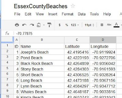
The first aspect of any process is “get the data”. I did this a year ago with the construction of the EssexCountyBeaches spreadsheet in Google Docs.
The second aspect of the process is “get the data into the program”. I was hoping to just import the data into Google Earth, but that fuctionality is only available in the Google Earth Pro version (which costs $399 per user per year). Of course there are a number of other features, but let’s stick with the free version for now.
Open the EssexCountyBeaches spreadsheet in Google Docs:
Open Google Earth (I have set Essex County, Massachusetts as my Starting Location). Go to Add > Folder, and call it Essex County beaches. It will appear in your list of My Places:
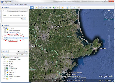
Since we want to start our tour at the “Essex County overview”, go to Add > Placemark. Call it Essex County, and click OK. It now appears in your “Essex County beaches” folder:

Let’s go to the first beach (Joseph’s Beach in Nahant). Copy the latitude from the spreadsheet into the Fly To box in Google Earth

Then type a comma in the Fly To box, then copy the longitude from the spreadsheet into the Fly To box in Google Earth, then click the fly to/begin search button. Google Earth flys you to the beach:
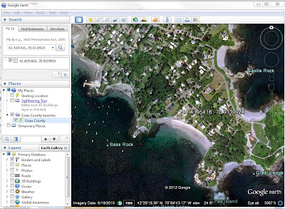
Go to Add > Placemark, Name it “Joseph’s Beach”, and click OK. It now appears in your “Essex County beaches” folder:

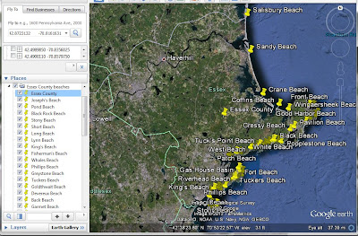
Repeat the process for the other 48 beaches. Once in a while you will back-track. When that happens, continue and get the Placemark into your list, then just click on it in the list and move it up. When you are finished, double-click on “Essex County” in the Essex County beaches folder, and get taken to an overview:
To make a Tour, click on Add > Tour, and the record icon apears in the lower-left corner of the map:

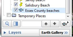
Click the red dot to start, then double-click the first beach (Joseph’s Beach). After you zoom-in, pause, then double-click the next beach. Continue until you finish, then click the red dot to stop. When the tour plays, click the Save icon, and name it “Essex County beaches”. The tour now appears at the bottom of the list in the Essex County beaches folder. The Play Tour icon has a picture of a movie camera – click it to play the tour.
Click on this link to download the zip file containing Google Earth places and tour
download the zip file
Unzip the file, and then open the kmz file in Google Earth. Have Fun!
No comments:
Post a Comment