Monday, May 30, 2011

5/30/2011 Maps for the 2010 Census, Part 1

To support the distribution the information associated with the 2010 Census, the U.S. Census Bureau has launched an "Interactive Population Map". Start at the Census Bureau website (www.census.gov) and click on the link for 2010 CENSUS BRIEFS

This takes you to the PRESS KITS webpage. Click the 2010 Census Home tab, then click the DATA link, then click the Interactive Population Map link:

At the Interactive Map page, click the POPULATION link; in the popup window, enter Essex County, Massachusetts and click the FIND button. After the map loads, use the + tool to zoom-in. When appropriate, change the GEOGRAPHICAL LEVELS to County / Municipio. Hover your mouse over the map, and the population numbers pop-up: 743,159

To see the distribution-by-towns, change the GEOGRAPHICAL LEVELS to Minor Civil Division. Hover your mouse over Newbury, and the population numbers pop-up: 6,666

Unfortunately, the county looks incomplete: where are Haverhill, Methuen, and Lawrence? What about Gloucester, Beverly, Peabody and Salem?
Change the GEOGRAPHICAL LEVELS to Place. Hover your mouse over Lawrence, and the population numbers pop-up: 76,377

The display over Google Maps is very clean and intuitive - unfortunately, as I discussed in my May 2, 2011 posting, when you work with Census Data: Be Careful! By going back-and-forth between Place and Minor Civil Division, you see a geography for Andover CDP, as well as a geography for Andover town


Once you are aware of the limitations of working with the data, this Interactive Map is a great tool. Looking forward, I am excited to see how they will display data at the Census Tract-level.

The next blog (Part 2) will discuss the interactive maps being released by USA Today.

Monday, May 23, 2011

5/23/2011 Mapping the beaches of Essex County

The weather is warm, and summer is coming! I want to, in Google Maps or Google Earth, soar (Navigate/Pan Through Points) from beach-to-beach on the North Shore of Boston, going from Joseph’s Beach down in Nahant up to Salisbury Beach in Salisbury. I LOVE that in Google Maps, when you specify a "nearby" place, the map just slides over to the new location (there is no jerky/jumping/redrawing).

A Google search of “beaches Essex County, MA” results in the MA HomeTownLocator page, with a list of the beaches in Essex County:

Clicking on a beach’s Name takes you to specific Maps, Driving Directions & Local Area Information for that beach:

Open a new spreadsheet, type in the beach names, and, for each beach, its Latitude and Longitude:

Since the Essex County coastline runs nearly vertical (except around Gloucester/Rockport/Essex), sort the file by ascending Latitude:

There are a few ways to work with maps online; for the "Navigate/Pan Through Points"-aspect that I want, I like to use map a list:

Map A List uses Google Spreadsheets for its data, so open your Google Docs account copy your spreadsheet into a new Google Spreadsheet, and save it. Open an account in Map A List, link to your Google Spreadsheet, tickle your default zoom up to 12, and View it:

Click the Navigate (airplane) icon at the bottom, and your map goes from beach-to-beach! (unfortunately, it looks like it does a random path through the points, which isn't what I had in mind. But I have an email into their help desk, so we will see what develops.)
Here is a link to the interactive map:
interactive map

Monday, May 2, 2011

5/2/2011 American Community Survey (U.S. Census Bureau)

A subtitle should be “Working with Census Data: BE CAREFUL!”

This morning, the Merrimack Valley Planning Commission hosted a Census Data Workshop at Northern Essex Community College in Haverhill, MA. Laura Medrano represented the U.S. Census Bureau, and showed us how to access both Census 2010 data and American Community Survey data through the Census Bureau web site. For this demostration, we will examine Social Characteristics from the American Community Survey for Andover, MA.

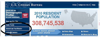
Go to the Census Bureau Home Page, and click on the “American FactFinder” text:


You currently have both factfinder and factfinder2 available.
Click factfinder.census.gov
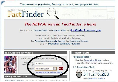
At the FactFinder screen, type Andover for City, select Massachusetts from the drop-down list, and click GO


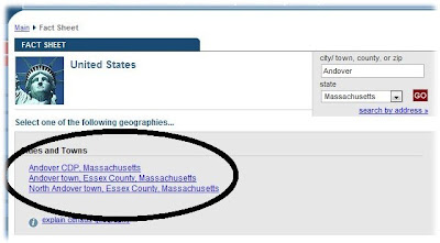
Unfortunately, three listings appear:


We know that North Andover is a different city/town from Andover, so we can ignore it. But what is the difference between Andover CDP and Andover town, Essex County?
And is there any difference in the data?

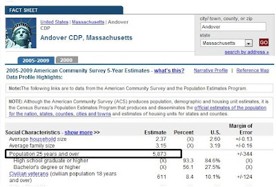
Click the link for Andover CDP (CDP stands for Census Designated Place), and the Fact Sheet appears:

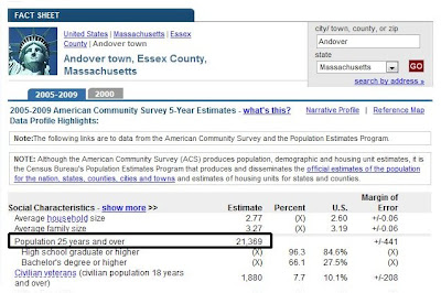
Print this page (or take a screen-shot), then go back to the Andover listings and select the link for Andover town, Essex County, and the Fact Sheet appears:

Well, you can see that there is a huge difference between the two listings!

Unfortunately, the Glossary is confusing (click on Glossary and find "Census designated place" and "Town").
Which means we must go to the map for clarification. Close the Glossary window.
On the left, click MAPS > Reference Maps


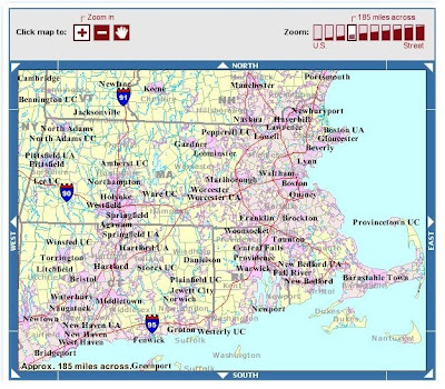
In the REFERENCE MAPS window, select Massachusetts from the State pull-down menu, and click GO. A Big Messy map appears:

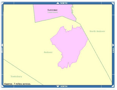
If we zoom-in on Andover, and adjust the Boundaries being displayed, we see a pink Andover - Census Designated Place within the Town Boundary of Andover:


Which gets us back to our first line:

If you are Working with Census Data (“Andover, MA”): BE CAREFUL!

To download a 10-page expanded document (with extensive screenshots), click herehttp://www.dixonspatialconsulting.com/AmerCommSurvey.doc