Tuesday, March 26, 2013

3/26/2013 Artists in Museums on Google Maps

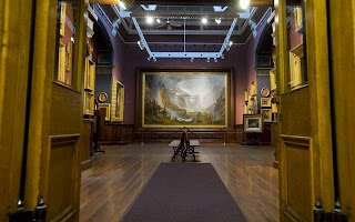
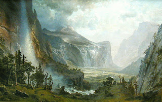
I am in a project tracking down Albert Bierstadt paintings (and Asher Durand, and Elijah Walton, and Frederic Church, and Jasper Cropsey, and J.M.W. Turner, and John Kensett, and Thomas Cole, and Thomas Hill, and Thomas Moran, and William Stanley Haseltine). This quest/project began because my wife and I will be visiting Yosemite National Park later this year. I took out Yosemite: art of an American icon from the library. It had a picture of Domes of the Yosemite, and credited it to St. Johnsbury Athenaeum in St. Johnsbury, VT. So we took a road trip up 93 a few weeks ago and saw this magnificent work of art (10 feet high by 15 feet wide) in person!


(click on the image to link to a BIG PICTURE!)

Which led me to Albert Bierstadt: Painter of the American West by Gordon Hendricks - a wonderful book with a section in the back listing the locations/collections of Bierstadt's paintings ("Check List of Paintings by Bierstadt"). As a GIS-guy/visual learner, I wanted to see these on Google Maps, so I made this:
click here for wheresbierstadt map

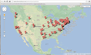
I list 133 Albert Bierstadt paintings in 90 locations - each map icon is on the exact location of the museum. The info window lists information regarding the significant pieces, hyperlinks to larger images and hyperlinks to each institution's web page.

The zoom is set to display all the museums in the database in the continental USA:
For this example, zoom-in on the High Museum of Art in Atlanta, GA, and click on the placemarker to get the info window:
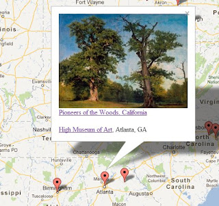

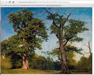
The image hyperlinks to a large hi-res picture:

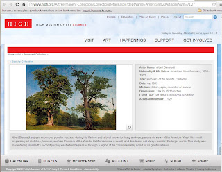
The picture title hyperlinks to the picture's information page:

The museum name hyperlinks to the museum's home page:


And, once you start zooming in
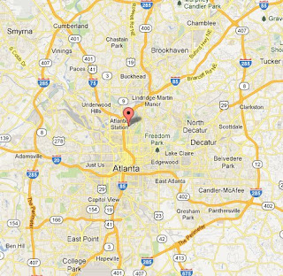

you will see that the placemarker is positioned at the museum's location:
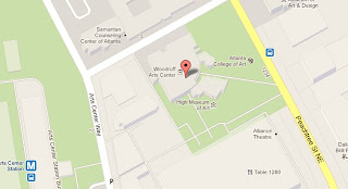

One of our daughters is in New Haven, and I am very excited to see where the Bierstadt paintings are between the North Shore and New Haven!
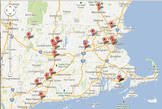

If you enjoy this, please check out the maps I made for Thomas Moran, Thomas Hill, and William Stanley Haseltine!

And stay tuned for more artists maps!

DISCLAIMER: Since "collections rotate" and "paintings are loaned out", please call ahead to confirm the art is actually on display!

Thursday, March 7, 2013

3/7/2013 Gettysburg/Civil War maps

I must apologize - in my last post, I feel that I was rather casual about the set of Gettysburg/Civil War maps. Produced in 1876, they are wonderful maps that tell the story of the three days of the Battle of Gettysburg, July 1-3, 1863 (one map for each day):


As explained on the visit-gettysburg web site,the Union positions are in blue and the Confederate positions are in red.

Before they went out of business, Borders sold a great (BIG!) $19.99 book called Maps of War amazon link. I bought a copy for myself, then I bought another copy to cut up and frame the maps!

These maps are also available from the Library of Congress web site

I believe these maps were originally published as part of ATLAS TO ACCOMPANY THE OFFICIAL RECORDS OF THE UNION AND CONFEDERATE ARMIES. In 1999, the original was offered at $1,200, and reprints/reproductions were available for $150/$200.

Wednesday, January 2, 2013

1/2/2013 more Maps (on Google Maps)

As a follow-up to my last blog, I want to see how some of my favorite areas/images/maps look on Google Maps. I first visited Stonehenge in July 1971, and was blessed to be able to take my wife Wendy there in June 2008. Coming from the east, you go over a rise and the Salisbury Plain is spread out before you, with Stonehenge in the middle of a fork-in-the-road (A303 is the main road going southwest, and A344 is the other road going northwest). In 1971 you could wander among the stones themselves, but the area had been restricted by 2008. In response to research stressing the importance of "the Avenue" to the northeast of Stonehenge, English Heritage (the organisation [love British spelling!] responsible for sites of antiquity) recommended the closing of a section of A344 because it "severs the alignment, to enable the stone circle to be reunited with the Avenue." I did a search on Images for "stonehenge site plan" and grabbed seven that look like fun.
The links are http://www.dennisdixon.net/Stonehenge/Stonehenge1.htm through .../Stonehenge7.htm:
Another series of maps that I love are those that were done by the Federal Government of the three days of battle at Gettysburg in the Civil War. The link to this map-on-Google-Maps is http://www.dennisdixon.net/Stonehenge/Gettysburg1.htm:
Have fun zooming-in, panning around, and turning the layer on-and-off.